



Annapurna Circuit Trek – 14 Days

img
img
img
img
img
img
img
img
img
img
img
Image
Image
Image
Image
Image
Image
Image
Image
Image
Image
Image

Annapurna Circuit Trek – 14 Days

$950.00/Person

The Annapurna Circuit Trek is one of Nepal's most iconic trekking adventures, circling the magnificent Annapurna Massif and crossing the legendary Thorong La Pass at 5,416 meters. This spectacular journey takes trekkers through diverse landscapes, traditional villages, ancient monasteries, lush forests, alpine valleys, and breathtaking Himalayan panoramas. Experience the rich culture of Gurung, Thakali, and Manangi communities while enjoying stunning views of Annapurna, Dhaulagiri, Manaslu, and Tilicho Peak.

At a Glance
duration
Trip Duration
14 Days
difficulty
Difficulty Level
Moderate to Challenging
activities
Activities
Trekking
accommodation
Accommodation
Teahouse
season
Best Season
Spring (March–May) Autumn (September–November)
meals
Meals
B.L.D , Breakfast, lunch ,dinner ,dry fruits ,seasonal fruits
altitude
Max Altitude
5416m
Overview

The Annapurna Circuit Trek is a world-famous Himalayan adventure that offers an incredible combination of mountain scenery, cultural immersion, and diverse landscapes. Starting with a scenic drive from Kathmandu to Dharapani, the trail gradually ascends through picturesque villages including Chame, Pisang, and Manang.

Acclimatization in Manang allows trekkers to adjust to the altitude before crossing the challenging Thorong La Pass (5,416m), one of the highest trekking passes in the world. After the pass, the trail descends into the sacred pilgrimage site of Muktinath and continues through the beautiful Kali Gandaki Valley before ending in Pokhara.

This trek is ideal for adventure seekers looking for a classic Himalayan experience with spectacular mountain views, unique cultures, and unforgettable trekking memories.


Trek Highlights

  • Cross the famous Thorong La Pass (5,416m)
  • Explore traditional Gurung, Manangi, and Thakali villages
  • Visit sacred Muktinath Temple
  • Stunning views of Annapurna, Dhaulagiri, Manaslu, and Tilicho Peak
  • Acclimatization day in Manang
  • Experience diverse landscapes from subtropical forests to alpine deserts
  • Trek through the world's deepest gorge, Kali Gandaki Valley
  • Scenic drive from Kathmandu and return via Pokhara
Itinerary
Day 1:
Drive from Kathmandu (1,320 m / 4,330 ft.) to Bhulbhule (845 m / 2,772 ft.)

We begin our first day with an early-morning drive from Kathmandu to Bhulbhule, stopping for breakfast by the riverside beside calm, flowing water.

Kathmandu → Besisahar → Bhulbhule → Ngadi

Following the Trishuli River, you will see terraced farms, green hills, waterfalls, and hillside villages before reaching Besisahar. On clear days, you can enjoy distant views of Ganesh Himal and Manaslu along the route. 

Beyond Besisahar, the road becomes narrower and more rugged as you follow the Marsyangdi River deeper into the mountains towards Bhulbhule.

As we enter the village, the first thing we do is register our trekking permits at the checkpoint

Moving forward, you cross a suspension bridge and trek for an hour to reach today's destination, Ngadi.

Max Elevation: 845m
Duration: 7 to 8 hour
Distance: (200km / 124 miles)
Accommodation: Teahouse
Meals: Breakfast, Lunch, and Dinner Included
Day 2:
Trek from Bhulbhule (845 m / 2,815 ft.) to Jagat (1,300 m / 4,265 ft.)

You should consider day one as “easing in” to the trek, as there are real walking days ahead. Day two marks the beginning of the actual trek as you leave Ngadi after breakfast.

Bhulbhule → Bahundanda → Ghemru → Syangi → Jagat

Following the marked trail beside the Marsyangdi River, you pass small waterfalls, a hydropower station, and signs reading “Off Road Manang”/ “Trekking Trails Manang.”

The trail continues through Bahundanda and Ghemru with corn fields and local people tending crops in their terraces in the morning sun. Here, you enjoy your lunch at Syangi with views of twin waterfalls before walking through more farmlands and rural settlements. 

As you get near Jagat, the road tightens along steep cliffs above the rushing river below. Tonight, you stay in this peaceful village to rest, recover, and prepare for the days ahead.

Max Elevation: Highest Altitude 1,300m / 4,265ft
Duration: Trek Duration 5 hrs
Distance: 16km / 9.9miles
Accommodation: Teahouse
Meals: Breakfast, Lunch, and Dinner Included
Day 3:
Trek from Jagat (1,300 m / 4,265 ft.) to Dharapani(1,860 m / 6,200 ft.)

The third day of the trek is full of beautiful views, lush greenery, suspension bridges, and adventurous rocky ledge paths. 

Jagat → Chyamche → Tal → Kodo → Dharapani

After leaving Jagat, you pass a big 202-meter waterfall before walking through single-track trails carved along a cone-shaped ridge and steep river drops towards Chyamche

Descending into greener valleys filled with a large number of trees and farmland, you find a gate welcoming you to the Manang district. From here, you continue down towards the river and make your way to the Tal village.

Leaving behind Tal with a fulfilling lunch, you are out along the route that runs tightly between the river and the towering mountain ridges. The landscape opens into a farmland with barley, rice, and potatoes near Kodo, the largest village in Manang Valley. 

The final stretch through rocky terrain and an uphill ascent to Stone Kani brings you to Dharapani. This major trail junction marks the official entry into the Manang region, offering a view of Thonche village across the river.

Max Elevation: Highest Altitude 1,860m / 6,200ft
Duration: Trek Duration 5 hrs
Distance: Trek Distance 15km / 9.3miles
Accommodation: Teahouse
Meals: Breakfast, Lunch, and Dinner Included
Day 4:
Trek from Dharapani (1,860 m / 6,200 ft.) to Chame (2,710 m /8,890 ft.)

The trail today enters dense pine, fir, oak, and maple forests as you follow a zig-zag track beside the Marsyangdi River. The trek is peaceful, with cattle grazing in open meadows and the sound of rushing water throughout the valley.

Dharapani → Danaqyu →  Timang → Koto → Chame

You pass Danaque, a quiet hillside village with terraced fields and stone houses, before ascending toward Timang. From here, you can enjoy the stunning views of Lamjung Himal, Annapurna II, and Annapurna IV.

After Timang, you can see the clear change in scenery. The trail descends through pine forests, small waterfalls, and scattered villages, often following quieter needle-covered trails.

On the way, you stop at Syarkhu for lunch before reaching Koto, a small but important crossroad village. It sits at the river confluence, connected by a colorful bridge, where you complete the permit checkpoint.

The final stretch to Chame is gentle, taking you along a gravel trail and the main dirt road. This town is the district headquarters of Manang, which welcomes you with modern lodges, shops, and a natural hot spring where you can rest and recover.

Max Elevation: Highest Altitude 2,610m / 8,890ft
Duration: Trek Duration 6 hrs
Distance: Trek Distance 15.5km / 9.6miles
Accommodation: Teahouse
Meals: Breakfast, Lunch, and Dinner Included
Day 5:
Trek from Chame (2,710 m / 8,890 ft.) to Upper Pisang (3,300 m / 10,826 ft.)

Today, our fifth day of trekking gets us even higher into the mountains up to Upper Pisang. 

Chame → Bhratang →  Dhukur Pokhari → Upper Pisang

After breakfast at Chame, you enter a steep, confined valley as the trail follows the Marsyangdi River through green fields and dense pine forests. 

You reach Bhratang, a small village known for its apple farm, where you can try fresh apple juice before continuing. Soon after, you catch your first close view of the massive Paungda Danda Rock, a huge curved rock formation rising above the river. 

You gradually ascend along forested trails until reaching Dhukur Pokhari for lunch. From here, you can enjoy the views of snow-capped peaks, including Annapurna II to the south and Pisang Peak to the northeast.

The landscape opens up as you descend into the Manang Valley, passing through Pisang village with stone houses and wooden buildings. 

You finally reach Upper Pisang, a culturally rich village with an ancient monastery, Tibetan-influenced lifestyle, and wide panoramic views of Annapurna IV. 

Max Elevation: Highest Altitude 3,300m/10,827ft
Duration: Trek Duration 5 - 6 hrs
Distance: Trek Distance 15.5 km/ 9.6miles
Accommodation: Teahouse
Meals: Breakfast, Lunch, and Dinner Included
Day 6:
Trek from Pisang (3,300 m / 10,826 ft.) to Manang (3,540 m / 11,614 ft.)

Today’s trek begins with a warm breakfast at Pisang before following the upper route through Geru (Ghyaru), Ngawal, and Barge. 

Upper Pisang→ Ghyaru→  Ngawal → Barge → Manang

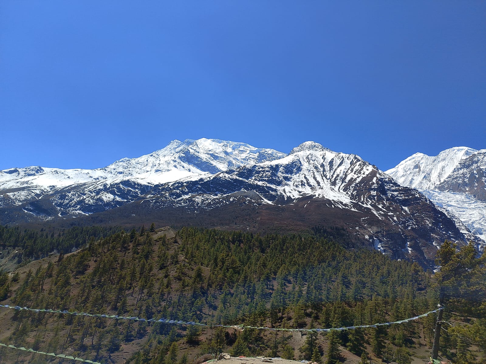
You pass mani walls and stone tablets before a challenging uphill trek to Geru, where wide mountain views begin to open up. From here, you can see the north faces of Annapurna II, Annapurna III, Annapurna IV, Gangapurna, Tilicho Peak, and Pisang Peak. 

The trail continues on a steadier incline with views of the valley below and forest-covered slopes until you reach Ngawal for lunch. As you ascend to higher elevations, the air gradually becomes colder, drier, and harsher. 

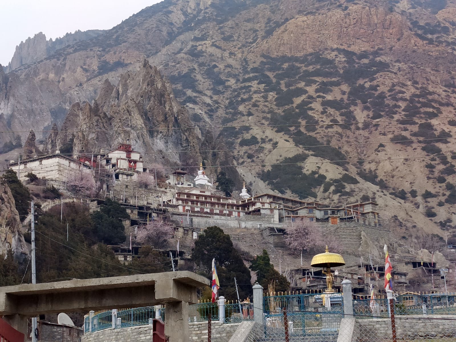
After lunch, the trail descends through forests toward Braga, the last village before Manang. Along the way, you can explore the region’s Buddhist culture through roadside stupas and a visit to Barge Monastery, the largest monastery in Manang. 

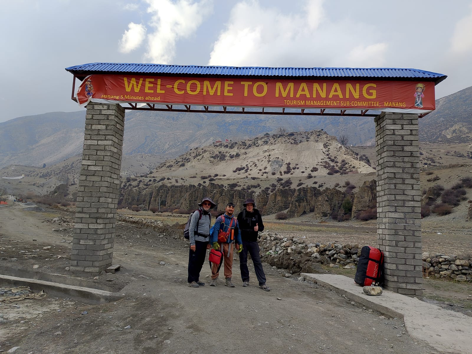
The trail continues past Buddhist shrines before reaching Manang Bazaar, where you can see yaks, mountain goats, and grazing horses on the surrounding hills.

Tonight, we stay at Himalayan Cottage in Manang, where you can enjoy comfortable rooms, a western toilet, hot showers, and laundry facilities before the higher-altitude days ahead.

Max Elevation: Highest Altitude 3,540m / 11,300ft
Duration: Trek Duration 5 - 6 hrs
Distance: Trek Distance 17km / 10.6miles
Accommodation: Teahouse
Meals: Breakfast, Lunch, and Dinner Included
Day 7:
Rest and Acclimatization day at Manang (3,540 m / 11,614 ft.)

It’s been a week on the trail, and today is your acclimatization day in Manang to help the body adjust to the higher altitude. Here, we follow the “Hike high, sleep low” approach, exploring Manang Village, surrounded by rugged mountains and alpine scenery. 

We do not just rest; instead, we go for an optional short hike around Manang. These side trips include Gangapurna Glacier Lake, Milerapa Cave, or Chongkor Viewpoint,  all offering wide views of the valley and surrounding peaks.

For a longer option, you can take a 6 –7 hour return hike to Ice Lake (Kicho Tal), with panoramic views of Annapurna III, Tilicho Peak, Pisang Peak, and Chulu Peak.

After the hike, we return to Manang and spend time resting, exploring cafés, bakeries, and small shops. Here, you can buy gear, winter essentials, and stock up on basic supplies and snacks for the next few days of the trek.

If needed, you may also visit the Himalayan Rescue Association in Vraja village for an AMS briefing, blood level check, and guidance on altitude sickness prevention or medication like Diamox.

Accommodation: Teahouse
Meals: Breakfast, Lunch, and Dinner Included
Day 8:
Trek from Manang (3,540 m / 11,614 ft.) to Ledar (4,210 m / 13,812 ft.)

Our eighth day on the Annapurna Circuit is one of the shortest trekking days, as we gradually gain elevation moving towards Ledar.

Manang → Tenki → Ghunsang → Yak Kharkha → Ledar

Leaving Manang, you cross a stream and ascend towards Tenki village through the juniper forests. From here, the trail follows the Marsyangdi Valley northwest toward the Jar Sang Khola Valley. 

The route gradually steepens with a challenging elevation gain of 400 meters until you reach Ghunsang. It is a small village known for its traditional flat mud-roofed houses, where you can enjoy views of the surrounding mountains and the winding river below.

Along the trail, you may spot eagles soaring above the sharp ridges and occasional alpine rodents roaming along the rocky terrain. 

You can observe that the trails are connected by road, but vehicles are prohibited in this conservation area. The narrow trail includes frequent ups and downs, and you may need to step aside for passing yaks and mules. 

After crossing a small wooden bridge, you reach the peaceful grassland of Yak Kharkha, where you stop for lunch and a short rest. During the trek, you often see yaks grazing in alpine pastures, along with mule trains and horses carrying supplies through the valley.

From Yak Kharkha, you cross a long suspension bridge and continue toward the quiet hamlet of Ledar, your overnight stop for today.

Max Elevation: Highest Altitude 4,250 m/13,9434 ft
Duration: Trek Duration 4 - 5 hours
Distance: Trek Distance 9.1 km / 5.65 miles
Accommodation: Teahouse
Meals: Breakfast, Lunch, and Dinner Included
Day 9:
Trek from Ledar (4,210 m / 13,812 ft.) to Thorong High Camp (4,925 m/16,158 ft.)

Leaving Ledar behind on our tenth day of Annapurna Circuit, we continue along confined alpine trails with steady elevation gain toward Thorong Phedi, the final stop before the pass. 

Ledar → Thorong Phedi → Thorong High Camp

The landscape becomes drier and rougher as vegetation slowly disappears into rocky terrain and steep mountain slopes. As you move ahead, you cross through the wooden bridges, some landslide-prone sections, and loose rocky routes. 

The uninhabited, challenging mountain terrain indicates that you are approaching Thorong Phedi. You often see yak herds, mule caravans, and blue sheep grazing along the mountain corridor. 

With a fulfilling lunch and a rest, you begin the steep uphill trek to Thorong High Camp. This uphill trek is short but physically demanding due to the thin air and increasing altitude.

Tonight, we stay at High Camp and prepare for the early morning crossing of Thorong La Pass the next day.

Max Elevation: Highest Altitude 4,925m/16,158 ft
Duration: Trek Duration 4-5 hrs
Distance: Trek Distance 7.3km /4.53 miles
Accommodation: Teahouse
Meals: Breakfast, Lunch, and Dinner Included
Day 10:
Trek from Thorong High Camp (4,925 m / 16,158 ft.) to Muktinath Temple (3,760 m / 12,623 ft.) via Thorong La High Pass (5,416 m / 17,756 ft.)

Today is the toughest yet most rewarding day of the trek as you make an early 3 AM ascent from High Camp toward Thorong La Pass. The trail moves upward through icy air and snow-covered sections. It can be slippery, where your pace naturally slows.

Thorong High Camp → Thorong La Pass → Muktinath

As you approach the pass, prayer flags come into view, marking your entry point at one of the highest navigable passes in the world. At the top, you stand surrounded by Annapurna Massif, Dhaulagiri, and the Chulu ranges, on one side, with views stretching toward Tibet on the other.

You can click many pictures and videos while enjoying hot drinks or snacks at a small teahouse near the pass. Now, you begin the long descent toward Muktinath

It is the longest steep downhill trek, zig-zagging through snow, mud, or loose gravel, making it demanding on the knees.

The landscape gradually shifts into dry, red-hued mountains and small villages as you approach the sacred pilgrimage site of Muktinath, locally known as Ranipauwa.

The Buddhists called it Chumig Gyatsa in Tibetan (“Hundred Waters”), a holy place for both Buddhists and Hindus. Here, you can see the 108 water spouts and the eternal flame that has been burning for centuries.

We stay at the teahouse tonight, enjoying warm food and exploring the town. You can explore the streets with Buddhist monasteries and Hindu shrines surrounded by pilgrims, prayer flags, and small market flower stalls. 

Max Elevation: Highest Altitude 5,416m /17,756ft
Duration: Trek Duration 9 hrs
Distance: Trek Distance 15.6km / 9.6miles
Accommodation: Teahouse
Meals: Breakfast, Lunch, and Dinner Included
Day 11:
Drive from Muktinath to Tatopani (1,200 m / 3,937 ft.) through Jomsom (2,720 m / 8,924 ft. )

We wake up early in the morning and head toward the Muktinath Temple before beginning our downhill journey by local bus to Tatopani.

Muktinath → Kagbeni → Jomsom →  Tatopani

The landscape becomes more arid and desert-like, but with some specks of green vegetation as we move towards Kagbeni. You can see a glimpse of Upper Mustang while visiting Kag Chode Thupten Samphel Ling Monastery and a school for young Buddhist monks.

Following an old monastery with colorful frescoes, ceremonial masks, and artefacts, you walk through maze-like alleyways lined with stone houses and small archways. 

From here, we set off along the dry hills, dusty riverbed, unpaved roads, and windy sections toward Jomsom. Here, you can enjoy picturesque apple orchards.

The road becomes bumpier as you pass through deep river valleys on the way to Tatopani, known for its natural hot springs. 

We stop at this village, soaking in warm waters and relaxing after the long journey. It is believed to have healing properties for tired muscles and skin conditions. 

Max Elevation: Highest Altitude 3,760m / 12,623ft
Duration: Driving hours (71km /44.55miles ) 3-4 hrs
Accommodation: Teahouse
Meals: Breakfast, Lunch, and Dinner Included
Day 12:
Trek from Tatopani (1,200 m / 3,940 ft.) to Ghorepani (2,860 m / 9,385 ft.)

Today is Day 12 of the Annapurna Circuit Trek and one of the longest and toughest trekking days. You begin your journey after breakfast with a steady uphill trek through Thakali villages such as Sikha and Chitre toward Ghorepani. 

Tatopani → Ghara → Sikha → Chitre → Ghorepani

Leaving the natural hot springs of Tatopani, you cross the eastern side of the Kali Gandaki River and follow the dirt road along the hillside. You pass through Ghara, a bustling village where houses are built into steep slopes. 

As you continue, the trail opens up to views of snow peaks and wide valleys. A major uphill section awaits you before reaching Sikha, where you cross a checkpoint and stop for a warm Thakali lunch to fuel for the second half of the day.

From here, all you need is to hike upward through the continuous stone stairs to Ghorepani. Along the route, you pass through farmlands and dense forests filled with rhododendron, birch, and magnolia trees. 

You pass Chitre with sweeping views of the Annapurna and Dhaulagiri ranges before making your way to the final stop of the day. 

Ghorepani is a beautiful hilltop village known for its Pun- Magar culture. It is your overnight stay to rest after your long trekking and prepare for the sunrise hike the next morning. 

Max Elevation: Highest Altitude 2,860m / 9,385ft
Duration: Trek Duration 6-7 hrs
Distance: Trek Distance 17km / 10.5miles
Accommodation: Teahouse
Meals: Breakfast, Lunch, and Dinner Included
Day 13:
Early-morning hike to PoonHill (3,210 m / 10,531 ft.). Trek to Ulleri (2,050 m / 6,725 ft.). Drive to Pokhara (1,070 m / 3,510 ft.)

Today marks the final day of trekking section on the Annapurna Circuit, combining an early morning hike to Poon Hill, a trek to Tikhedhunga, and a drive back to Pokhara.

Ghorepani → Poonhill → Ghorepani → Tikhedhunga → Pokhara

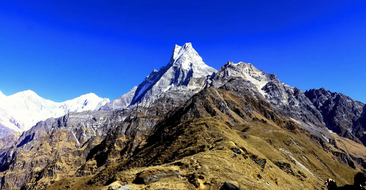
The day begins before 4 AM with an early morning hike to Poon Hill, one of Nepal’s most famous sunrise viewpoints. From the viewpoint tower, you can enjoy close views of the Annapurna and Dhaulagiri ranges, including the iconic Machhapuchhre peak (Fishtail).

As the first light reaches the mountains, the snow-covered peaks slowly glow under the sunrise, making Poon Hill one of the most favoured photography spots in the region. After enjoying the scenery and taking photographs, you return to Ghorepani for breakfast.

The trail passes through forests and stone staircases before reaching Ulleri, a scenic traditional village known for its stone-paved trails.

We take a bus along the rough and dusty roads via Tikhedhunga to reach Nayapul. From here, we head towards our hotel for rest. 

You may have time to explore the Lakeside area and relax in Pokhara before attending a farewell gathering in the evening

Max Elevation: Highest Altitude (3,210m / 10,525ft)
Duration: Trek Duration 4-5 hrs
Distance: Trek Distance 12.5km / 7.7miles
Accommodation: Teahouse
Meals: Breakfast, Lunch, and Dinner Included
Day 14:
Drive from Pokhara (820 m / 2,690 ft.) to Kathmandu (1,320 m / 4,330 ft.)

Today is the 14th day, which brings the completion of your Annapurna Circuit journey.

Pokhara → Kathmandu

After breakfast at the hotel in Pokhara, we board a tourist bus and begin the drive back to Kathmandu, saying a final goodbye to the lakeside city. 

The journey follows the Marsyangdi and Trishuli Rivers, passing hills, river valleys, riverside fields, and roadside houses along the way.

As the road winds through the countryside, you reflect on the journey you’ve completed: steep or narrow pathways, snow-capped peaks, high passes, forests, rare wildlife, and remote villages.

By evening, you arrive in Kathmandu, where your trekking journey officially comes to an end.

Max Elevation: 1400 m
Distance: Driving hours (200km / 124miles) 7-8hrs
Accommodation: Teahouse
Meals: Breakfast, Lunch, and Dinner Included
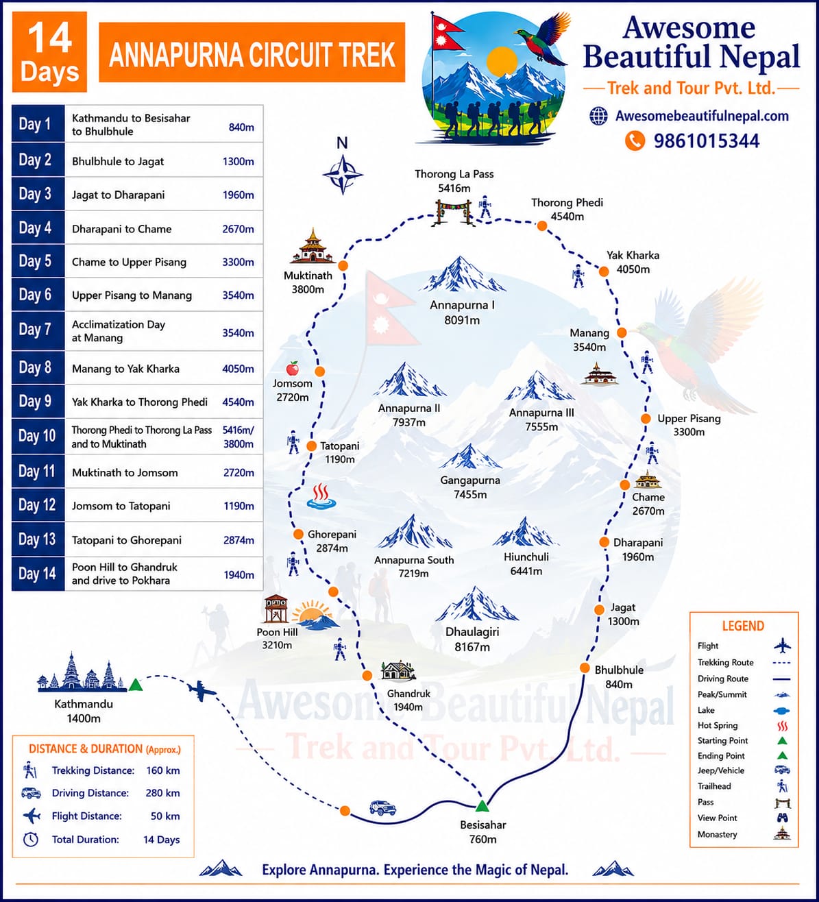
Map

Trip Inclusions

✅ Airport pick-up and drop-off

✅ Kathmandu hotel (2 nights)

✅ Pokhara hotel (1 night)

✅ Tourist bus transportation

✅ Annapurna Conservation Area Permit (ACAP)

✅ TIMS Card (if required)

✅ English-speaking licensed trekking guide

✅ Guide's salary, food, accommodation, insurance

✅ Tea house accommodation during trek

✅ All government taxes

✅ Company service charge

✅ Trek completion certificate

❌ International airfare

❌ Nepal entry visa fees

❌ Travel insurance

❌ Lunch and dinner in Kathmandu & Pokhara

❌ Personal trekking equipment

❌ Hot shower, WiFi, battery charging

❌ Alcoholic and soft drinks

❌ Tips for guide and porter

❌ Emergency rescue expenses

❌ Personal expenses

Departure dates

Start Date
End Date
Price
Status
01 Oct, 2026
15 Oct, 2026
US$ 940
Available
05 Oct, 2026
20 Oct, 2026
US$ 940
Available

Departure dates

From 01 Oct, 2026
To 15 Oct, 2026
US$ 940
From 05 Oct, 2026
To 20 Oct, 2026
US$ 940
Useful Informations

Best Season

  • Spring (March–May)
  • Autumn (September–November)

Trek Difficulty

Moderate to Challenging

Maximum Elevation

Thorong La Pass – 5,416m

Accommodation

Tea Houses and Local Lodges

Food

Nepali, Tibetan, Indian, Continental and Local Cuisine

Required Permits

  • ACAP Permit
  • TIMS Card (when applicable)

Physical Fitness

Good physical fitness and prior hiking experience are recommended.

Reviews

Leave a Review

Book Your Trip Now!

US $950 x 1 guests: US $950
Total US $950
CUSTOMIZE

Similar Packages

image
Annapurna Region

Mardi Himal Trek

2 reviews

$500.00

9 Days Trip Details
image
Annapurna Region

Ghorepani Poonhill Trek

0 reviews

$450.00

8 Days Trip Details
image
Annapurna Region

Annapurna Base Camp Trek

0 reviews

$750.00

14 Days Trip Details