EVEREST 3 PASSES TREK

img
img
img
Image
Image
Image

EVEREST 3 PASSES TREK

$1700.00/Person

Everest Three High Passes Trek is the ultimate trek for thrill-seekers and adventurers in the Everest region. In this trek, you will not only reach the Everest Base Camp but also cross the three highest passes in the Khumbu region – Kongma La Pass (5,535/18,159ft), Cho La Pass (5420m/17,782ft), and Renjo La Pass (5,340m/17,520ft).

At a Glance
location
Destination
Everest Region
duration
Trip Duration
17 Days
difficulty
Difficulty Level
Challenging
activities
Activities
Trekking
accommodation
Accommodation
Teahouse
season
Best Season
spring/autumn
meals
Meals
B.L.D , Breakfast, lunch ,dinner ,dry fruits ,season fruits
altitude
Max Altitude
5550 m
Overview

Everest Three Passes Trek Overview

The Everest Three Passes Trek Itinerary, offered by Awesome Beautiful Nepal, is as 17-days long adventure in the mountains. Over these 17-days, you cross three high Himalayan passes, explore 4 valleys, take a thrilling mountain flight, and explore Everest Sherpa traditions and villages to the fullest.

The Everest Three Passes Trek, also known as the Everest Circuit Trek, is one of the most challenging and complete trekking adventures in Nepal. Everest Circuit Trek takes you to the prodigious Everest Base Camp (EBC), and the journey goes wide and beyond to uncover the true, remote landscapes, the best of the Khumbu region.

This trek begins with a scenic flight to Lukla and continues through sub-alpine forests and rocky terrain to Namche Bazaar. From Namche, trekkers can choose either clockwise or counterclockwise. The popular itinerary route planned by Awesome Beautiful Nepal follows the anti-clockwise Everest Three Pass Trek route.

Meaning, the trek first follows towards Everest Base Camp and Kalapatthar via Kongma La Pass (18,159ft/5,535m). Then, towards Gokyo Valley, crossing Cho La Pass (17,782ft/5,420m), finally cross Renjo La Pass (17,560ft/5,360m).

The second route is clockwise, first crossing Renjo La (Renjo Bhanjyang) and finally towards EBC (Khumbu Valley). This route takes trekkers directly to around 3,500 meters, towards Lungden and Gokyo Valley, posing a significant risk of altitude sickness.

So, we recommend following an anti-clockwise route, allowing trekkers enough time to acclimate and rest.

Nevertheless, the trail involves ever-changing glacier crossings, a rocky, slippery route, high-altitude, remote terrain, basic accommodation, and unpredictable weather. For such conditions, you might want to pack crampons, microspikes, trekking poles, and warm clothes.

Therefore, this trek is recommended only for experienced, physically and mentally prepared trekkers

Itinerary
Day 1:
Flight to Lukla from Kathmandu and trek to Phakding Route: Kathmandu → Lukla → Chheplung → Thado Koshigaon → Ghat → Phakding
  • Beginning Point: Kathmandu (1400 m/4593 ft)
  • Trek Beginning Point: Lukla (2840 m/9318 ft)
  • Ending/Overnight: Phakding (2618 m/8589 ft)
  • Lukla to Phakding Distance: 7.8 km (5 miles)
  • Total Descent: 222 meters (728 ft) from Lukla
  • Lunch: Thado Koshigaon

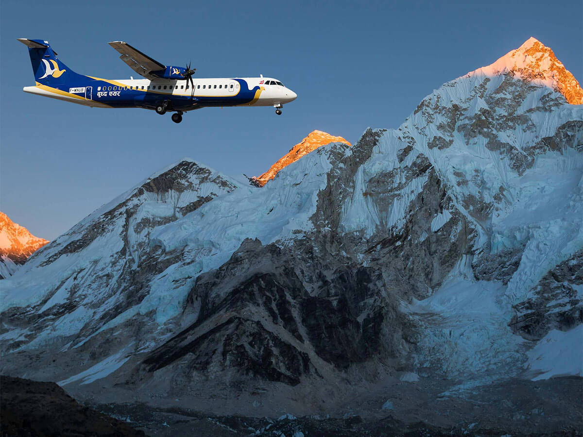
The three passes adventure starts with one of the most scenic and thrilling flights in the world: the Lukla flight. A 25-30 minutes Lukla mountain flight takes trekkers from Kathmandu (or Ramechhap, depending on season) to Tenzin Hillary Airport (Lukla Airport).

You will most likely have breakfast at your hotel in Kathmandu (if the flights depart from Kathmandu) or in Ramechhap. Or you can have breakfast in Lukla too if we take an early morning flight.

Lukla is the entry zone to the Everest region in Nepal. You will go through Thado Koshigaon, Chheplung, Chaurikharka, and then Phakding. The majority of people living here are Sherpa.

There are about 50-60 local houses and 20-30 good-quality teahouses. Each teahouse provides basic facilities to meet visitors’ needs. The Local sherpa  run the Teahouses 

You will have basic services like a hot shower, Wi-Fi, electricity, and charging, as well as an attached bathroom. However, the attached bathroom may not be available at teahouses.

As our first day includes a morning flight and directly takes trekkers from 1,400 meters (Kathmandu) to 2,840 meters (Lukla), it’s common to feel slightly tired or under-rested. So, we are going to have a short first trekking day from Lukla to Phakding, about 8 km (5 miles), about 2.5 to 3 hours’ walk.

We will arrange our trekking team, arrange our luggage, and have some food (if needed), and finally start the trek. It’s an easy trail navigating through picturesque Sherpa villages. You’ll pass mani walls, prayer wheels, and stone stupas.

Make sure you walk clockwise around these religious landmarks. It’s a disrespect to walk anti-clockwise.

You’ll cross two suspension bridges, including one over the Dudh koshi river. It’s likely that you have never seen a suspension bridge, so it’s going to be one hell of an experience.

If the weather is clear, you can also see views of Numbur Himal and Kusum Khanguru along the trail. Furthermore, you’ll see yak caravans and porters carrying supplies to the villages ahead.

After walking up and down, through lively villages such as Chheplung, Thado Koshigaon, and Ghat, we will reach Phakding. It is also our lunch and overnight stay place on our 1st day of the Everest Base Camp and Three Passes Trek.

Phakding is a bustling yet peaceful village. You can find good quality, comfortable accommodation here, welcoming and perfect for resting. Trekkers can order any one meal from the menu for lunch, dinner, and breakfast, included in the trip package.

After reaching Phakding, if we get time, we can visit Phakding Monastery, too.

Phakding is a large Sherpa village in the Khumbu region. There are about 20-30 local houses, where around 150 people reside. Phakding has health posts, monasteries, and schools operating up to the primary level.

Additionally, there are about 15-20 teahouses in Phakding. Each teahouse provides the basic services and amenities as in Lukla. The cost for the hot shower is NPR 300 (about $2) in Phakding, and no additional cost for Wi-Fi and electricity. You will live in a cozy guesthouse with an attached bathroom.

If Everest Base Camp is a dream, the Everest Three Passes Trek is what happens when you decide to go further. This trek doesn’t rush you. It lets you walk, breathe, struggle, rest, and look around. The Everest Three Passes Trek is as much about the journey between places as it is about the destinations and the 3 passes themselves.

But let me tell you one thing – this trek is not everyone’s cup of tea. It’s a trek that demands effort and patience. Long walking days, high altitude, and unpredictable mountain conditions require you to slow down, listen to your body, and respect the journey.

As compensation, Everest 3 passes awards trekkers the quiet valleys, friendly people, rich Sherpa culture, and some of the most spectacular landscapes in the Himalayas. In addition to the world’s tallest mountain, Mount Everest (8848.86 m/29,032 ft), trekkers can enjoy panoramic views of Makalu (8,516 m), Lhotse (8,516 m), Amadablam (6,812 m), etc.

This is not a journey measured only in kilometers or altitude, but in endurance, perspective, and stories you’ll carry for a lifetime. If you’re up for long days, high passes, and unforgettable mountain moments, this is where the real Everest adventure begins.

Max Elevation: (2,860 m / 9,383 ft)lukla
Duration: 30 Min Flight
Distance: 3 to 4 hour
Accommodation: Teahouse
Meals: Breakfast, Lunch, and Dinner
Day 2:
Trek from Phakding (2,650m /8,562ft ) to Namche Bazaar (3,440m / 11,285ft)

Trek Route: Phakding → Champute → Toktok → Bengkar → Monjo → Jorsalle → Hillary Bridge (Larja Dobhan) → Top Danda → Namche Bazaar

  • Beginning Point: Phakding (2618 m/8589 ft)
  • Ending/Overnight: Namche Bazaar (3440 m/11,286 ft)
  • Phakding to Namche Distance: 10.4 km (6.5 miles)
  • Total Ascent: 822 meters (2697 ft) from Phakding
  • Lunch: Jorsalle

After breakfast, usually between 7 and 7:30 am, our 2nd-day trek begins around 8 am. Starting early helps avoid trail congestion, especially during peak seasons. Today’s trek is going to be a little challenging; an uphill, downhill, and sometimes flat route. It’s about an 11 km (7 miles) walk, taking about 5-6 hours.

The trail continues along the Dudh Koshi River, with frequent ups and downs. You’ll cross a total of four suspension bridges, each higher and longer than the last. The most famous of these is the Hillary Suspension Bridge just before reaching Namche Bazaar, the highest bridge in the Everest region.

After a couple of hours’ walk, we’ll reach Monjo, the entry point of Sagarmatha national park There, your permits are checked, or you can also issue a new one if not already done in Lukla.

The section from Jorsalle to Monjo is relatively flat and shaded, making it a pleasant walk. There are high chances of spotting wildlife around this region. Trekkers can spot mountain goat, barking deer, Lophophorus (Danphe, the national bird of Nepal), and, on some rare occasions, you might be able to spot the rare species of red panda.

After walking for about 3 hours from Phakding, about half an hour from Monjo, we will stop at Jorsalle for lunch. There are about 5-7 basic teahouses in Jorsalle.

If you’re not hungry or walk faster, we can directly reach Namche Bazaar for lunch.

After we have a hearty lunch at Jorsalle, we continue our trek. Just about half an hour later, we will reach Larja Dovan, where we’ll cross the Hillary suspension bridge. Thereafter, the trail climbs steeply for about 2 houses before reaching Namche.

About half an hour up from the bridge, you’ll get the first clear view of Mount Sagarmatha (Mount Everest) from Top Danda. It is a moment that often leaves trekkers silent.

As you approach Namche Bazaar, often synonym to the ‘Gateway to Everest’, the settlement begins to get thick. The village is carved into the mountainside.

After reaching Namche Bazaar, you can spend the rest of the day resting in your lodge or visiting around the village. You can have your dinner at around 7 pm. After dinner, your guide will brief you on the next day’s walk, and you will finally go to sleep around 10 pm.

Namche bazar is the trade and cultural hub of Khumbu. It is a village consisting of 70-80 local houses. The majority of people are Sherpa, and a few are Rai people. It is also known as the European city of Nepal.

There are bakeries, gear shops, cafes, banks, and the best accommodation in the region.

There are about 40-50 teahouses, from basic to luxurious hotels, in Namche Bazaar. Wi-Fi and electricity are normally free, but the hot shower costs extra. It’s hard to get a single bedroom with an attached bathroom during the peak season, but arrangements can be made if booked in advance.

Meal : Breakfast, Lunch & Dinner

Accommodation : Guest House

Walking / Driving : 6 to 7 Hours (Walking)

Max Elevation: 3440 m
Duration: Trek Duration 6 hrs
Distance: Trek Distance 7.4km / 4.6miles
Accommodation: Teahouse
Meals: Breakfast, Lunch, and Dinner Included
Day 3:
Acclimatization day at Namche Bazaar- hike to Hotel Everest View

Today will be an acclimatization day at Namche. We recommend you to explore Namche Bazaar. This town contains numerous Wi-Fi-linked cafes, restaurants, souvenirs, and gear shops. There are other options - visit the Sagarmatha National Park visitor center, traditional Sherpa settlementsHillary School, Khumjung monastery, Dingboche Airport, and Everest View Hotel. 


Hike Route: Namche Bazaar → Hotel Everest View → Namche Bazaar

  • Namche to Hotel Everest View Distance: 7-8 km (4-5 miles)
  • Maximum Elevation: 3880 meters (12,795 ft)
  • Total Ascent: 460 meters (15.9 ft) from Namche Bazaar
  • Lunch: snacks at Hotel Everest View

Acclimatization is critical in any high-altitude trekking, so day 3 of this trek is going to be a rest day. It’s an active rest day, where we will climb high and sleep low.

After breakfast, we will start the hike around 7:30 am.

First, you will walk to Hillary Memorial Park. It’s an easy walk, located just 15-20 minutes from Namche. Here, trekkers can see the statue of Tenzin Norkay Sherpa, one of the first climbers of Everest. From this viewpoint, you can enjoy stunning views of Everest, Lhotse, Ama Dablam, Taboche, Thamserku, Kongde, and Khumbila.

After spending a few minutes there, we’ll continue uphill to Hotel Everest View, the world’s highest-located hotel. It’s an hour walk. Many trekkers stop here for tea, coffee, or light snacks (own expense). The up-close view of Everest from the terrace of Hotel Everest View is unforgettable.

Further, if you want to extend your trek, you can continue your trek towards Khumjung Village. It’s an authentic, traditional Sherpa settlement, home to the famous Yeti scalp relic. Khumjung is an hour’s walk from Hotel Everest View.

After visiting Khumjung, we’ll descend back to Namche Bazaar for lunch, or we can have it in between.

In the afternoon, you can visit local museums or explore local markets and cafes. Or, we can spend our day strolling around the Sagarmatha National Park visitor centre, Hillary School, Dingboche Airport, or nearby villages.

There are screenings of EVEREST DOCUMENTARIES at local bars and cafes in Namche Bazaar, particularly at ‘Liquid Bar’ and ‘Cafe Danphe’. These documentaries premiers are focused on Sherpa culture and Everest expeditions, from which you can enjoy and learn.

Or, you can also explore the local market. ‘Saturday Market’ on every Saturday is popular around where, where people sell locally handmade products.

This day plays a major role in helping your body adapt to altitude.

Max Elevation: 3880 m
Duration: 3/4 hour
Distance: 7-8 km (4-5 miles)
Accommodation: Teahouse
Meals: Breakfast, Lunch, and Dinner Included
Day 4:
Trek from Namche Bazaar to Tengboche / Dibuche

Trek Route: Namche Bazaar → Khyangjuma → Phunke Tenga → Tengboche → Deboche

  • Beginning Point: Namche Bazaar (3440 m/11,286 ft)
  • Ending/Overnight: Dibuche (3820 m/12,533 ft)
  • Namche to Deboche Distance: around 6.5 km (4 miles)
  • Total Ascent: 380 meters (1247 ft) from Namche Bazaar
  • Lunch: Phunke Tenga

After having a delicious breakfast in our lodge in Namche Bazaar, we will start today’s trek around 8 am. It’s a short and easy trail, about 6.5 km (4 miles, which is only a 4-5 hours’ walk.

The trail gradually ascends towards Khyangjuma/Kyangjuma, offering excellent views of Ama Dablam, Everest, Lhotse, and Taboche. After Kyangjuma, the path descends steeply to Phunke Tenga, a riverside settlement, which is also our lunch place. There is a check post in Phunke Tenga, where you’ll need to show your permits.

After crossing the suspension bridge over the river in Phunke Tenga, the trail climbs steadily for about 1.5 hours towards Tengboche. This section can feel demanding, especially in warm weather.

Tengboche is a beautiful village in the Everest region. There is a famous monastery here, Tengboche Monastery. It is estimated to be a 500-600 years old monastery, a spiritual center of Khumbu. The evening prayers, set against the backdrop of Ama Dablam, are deeply moving.

There are limited teahouses in Tengboche, only about 4 teahouses. So, if it’s crowded or for better comfort, you can continue to trek to Deboche/Dibuche. It’s a 30-minute downhill route, which offers better lodging. As it’s a commercial area, you can restock your snacks or even buy or rent trekking gear at Deboche.

Max Elevation: 3820 M
Duration: 4-5 hours HIKE
Distance: 6.5 km (4 miles)
Accommodation: Teahouse
Meals: Breakfast, Lunch, and Dinner Included
Day 5:
Trek from Tengboche / Dibuche to Dingboche

Trek Route: Deboche → Pangboche → Somare → Dingboche

  • Beginning Point: Deboche (3820 m/12,533 ft)
  • Ending/Overnight: Dingboche (4410 m/14,468.5 ft)
  • Deboche to Dingboche Distance: 8 km (5 miles)
  • Total Ascent: 590 meters (1936 ft) from Deboche
  • Lunch: Somare

The route from Tengboche (Deboche if last night’s accommodation is at Deboche) to Dingboche is known for one of the best Ama Dablam views on the entire trek.

If staying in Tengboche, the trail joins Dibuche after a short walk. From here, you pass through forests and cross the river before reaching Pangboche. You can choose to pass through Lower Pangboche (standard route) or take a side trip route through Upper Pangboche.

Pangboche is a small village in the Khumbu valley, home to one of the oldest monasteries in the region. Here onwards, the landscape begins to change noticeably; trees thin out, and the terrain becomes more alpine.

After walking for about 2 to 2.5 hours from Dibuche, we can reach Somare/Shomare, which will be our lunch place on the 5th day. It’s only about a 4-4.5 km walk, so if you can walk faster or don’t feel hungry, we can have snacks, tea, or coffee in Somare and then reach Dingboche for lunch. Dingboche is another 2 to 2.5 hours trek, about a 4 km walk.

If we have lunch in Dingboche, we have the rest of the day to explore the village.

Dingboche is a large settlement with stone-walled fields designed to protect crops from cold winds. There are about 25-30 teahouses, from basic to luxurious. Teahouses and additional amenities’ prices increase due to altitude and transportation challenges.


Meal : Breakfast, Lunch & Dinner

Accommodation : Tea House

Walking / Driving : 6 to 7 Hours (Walking)

Max Elevation: Dingboche (4410 m/14,468.5 ft)
Duration: 5 to 6 Hours
Distance: 8 km (5 miles)
Accommodation: Teahouse
Meals: Breakfast, Lunch, and Dinner Included
Day 6:
Acclimatization day at Dingboche- hike to Nagarjun Hill

Hike Route: Dingboche → Nagarjuna Hill Top → Dingboche

  • Dingboche to Nagarjuna Hill Top Distance: About 5 km (3 miles)
  • Elevation: Nearly 5100 meters (16,732 ft)
  • Total Ascent: Nearly 600 meters (1968.5 ft) from Dingboche
  • Lunch: Packed lunch

Day 6 of the Everest Three Passes Trek is our 2nd rest/acclimatization day in our itinerary. It is also an active rest day. Today, we will be hiking to the nearby viewpoint, Nagarjuna (Nangkartshang) Hill Top.

After breakfast around 7-7:30 am, you begin a steep hike to Nagarjuna Hill Top Viewpoint, situated at about 5,100 meters (16,732 ft). It’s a total of 4-5 hours’ walk (round trip), about 10 km (6 miles) hike.

The climb is demanding but rewarding. From the top, you’ll see an excellent view of:

  • Lhotse
  • Makalu (5th highest mountain in the world)
  • Ama Dablam
  • Kangtega
  • Lobuche Peak
  • Sweeping views of Dingboche village

We will spend about 20-30 minutes at the top before descending. We can also have some snacks, if we have packed any. Do not forget to keep the region clean. Carry back any nondegradable waste and dispose of it properly.

According to our standard Three Passes Trek itinerary, we’ll be back in Dingboche for lunch, followed by rest, light walking, or village exploration.

It’s a perfect place to get connected with your friends and family back home. You can visit nearby internet cafes, have a cup of Yak milk butter tea or coffee, and upload some memories.


Meal : Breakfast, Lunch & Dinner

Accommodation : Tea House

HIKING : Around 5 Hours HIKING (If the Trekkers want to)

Max Elevation: Nagarjun Hill 5100 meters (16,732 ft)
Duration: 4-5 hours
Distance: 5 km (3 miles)
Accommodation: Teahouse
Meals: Breakfast, Lunch, and Dinner Included
Day 7:
Trek From Dingboche to Chhukhung Trek Route: Dingboche → Chhukung
  • Beginning Point: Dingboche (4410 m/14,468.5 ft)
  • Ending/Overnight: Chhukung (4730 m/15,518 ft)
  • Dingboche to Chhukung Distance: 4.5 km (2.8 miles)
  • Total Ascent: 320 meters (1050 ft) from Dingboche
  • Lunch: Chhukung

Day 7 is a relatively easy and short trekking day. The trail is gentle and wide, allowing the body to recover. It’s a 2 to 2.5-hour trek, covering about 4.5 km (2.8 miles).

We’ll have our breakfast at our usual time, 7-7:30 am, then start our walk around 8 am. As you trek higher, you move deeper into the high alpine landscape. The trail follows a gentle valley beneath the Lhotse-Nuptse wall, with stunning views of Ama Dablam and Island Peak (Imja Tse).

As you move closer to Chhukung, the landscape becomes more rugged and dramatic.

You will reach Chhukung by late morning, around 10 to 10:30 am, then you can have some snacks or order lunch and have it. After having your food, now you can spend the rest of the day resting at your teahouse, exploring the village, or going for a hike to Chhukung Ri.

Chhukung is a small settlement used by Island Peak climbers and Three Passes trekkers. Here, you can meet climbers preparing for Island peak expeditions high-altitude guides, and fellow trekkers gearing up for the upcoming Kongma La Pass, the first pass among three.

There are about 5-6 teahouses in Chhukung, from basic to good quality accommodation, where you can spend a comfortable night’s stay. They provide Wi-Fi, hot showers, charging, etc., at an additional price.

Further, you can also restock your supplies and buy or rent trekking gear, if needed.

The village has a quiet, raw mountain atmosphere, making it a perfect place for acclimatization and to be mentally prepared.

For those who want extra acclimatization, an optional hike to Chhukung Ri is available (4-5 hours round trip), offering stunning views of Island Peak and surrounding glaciers.

Meal : Breakfast, Lunch & Dinner

Accommodation : Tea House

HIKING: 3 to 4 Hours 

Max Elevation: 4730 m/15,518 ft
Duration: 3to 4 hour HIKE
Distance: 4.5 km (2.8 miles)
Accommodation: Teahouse
Meals: Breakfast, Lunch, and Dinner Included
Day 8:
Trek from Chukhung to Lobuche via Kongma La Pass Trek Route: Chhukung → Kongma La Pass → Lobuche
  • Beginning Point: Chhukung (4730 m/15,518 ft)
  • Ending/Overnight: Lobuche (4940 m/16,207 ft)
  • Chhukung to Lobuche Distance: About 22 km (13.7 miles)
  • Total Ascent: 500 meters (1640 ft)
  • Lunch: Packed Lunch

This is one of the most demanding and rewarding days of the trek as you cross Kongma La Pass (5,535 m/18,159 ft).

Today, you’ll wake early, around 5 am, and have breakfast before starting. The trail starts with a long, steady ascent over rocky terrain. As you gain altitude, the landscape turns alpine. Especially the final push to the pass is steep and physically challenging, but rewarding.

From the top, trekkers can get breathtaking panoramic views of surrounding peaks, glacial valleys, and high Himalayan ridges.

It’s a long walk, and there aren’t any teahouses or villages along the way. So, you need to carry a packed lunch, snacks, and 2-3 liters of water for the pass.

The ascent to Kongma La Pass is long and rocky. It typically takes 4-5 hours to reach the top. After crossing the pass, the trail descends steeply toward Lobuche. This section requires careful footing and concentration, as the terrain can be loose and uneven.

While descending towards Lobuche, you’ll witness the end of the Khumbu Glacier, a challenging section where routes change every season.

After walking for 3-4 hours down the pass, we will reach Lobuche at around 1 to 2 pm. Then have your lunch and let your body rest and acclimate.

Once you have your lunch, you can explore around the village. It’s a traditional Sherpa village, so you can visit around the village and even interact with them.

Lobuche has around 9 basic teahouses and can be very cold, especially at night. Therefore, carrying a warm sleeping bag (rated -20°C) is mandatory.


Meal : Breakfast, Lunch & Dinner

Accommodation : Tea House

HIKING : 8 TO 9 HOUR 

Max Elevation: Kongma La Pass 5,545 meters (18,209 feet)
Duration: 8 TO 9 hour according to Trekkers pace
Distance: 22 km (13.7 miles)
Accommodation: Teahouse
Meals: Breakfast, Lunch, and Dinner Included
Day 9:
Trek from Lobuche to Ghorakshep- Hike to Everest Base Camp Trek Route: Lobuche → Gorakshep → Everest Base Camp → Gorakshep
  • Beginning Point: Lobuche (4940 m/16,207 ft)
  • Ending/Overnight: Gorakshep (5140 m/16,863.5 ft)
  • Lobuche to Gorakshep Distance: About 12 km (7.5 miles)
  • Maximum Elevation: 5364 meters (17,598 ft) at EBC
  • Total Ascent: 454 meters (14,89.5 ft) from Lobche to EBC
  • Descent: 224 meters (735 ft) from EBC to Gorakshep
  • Lunch: Gorakshep

After breakfast around 7 am, we will begin our trek to GORAKSHEP (2.5-3 hours). After lunch, we will continue hiking to Everest Base Camp, a 3.5-hour round trip over glacial terrain.

The route to the Gorakshep is rocky and barren, with thin air. So, have a steady pace and drink enough water, you might not feel like it, but cold drain body fluid quickly.

After reaching Gorakshep, we will now check into one of the best teahouses and order our lunch. Once we have a belly full of lunch, we leave our bags in the teahouse and start the most-awaited hike, the Everest Base Camp.

The trail passes through glacial moraine, offering views of icefalls, towering seracs, and surrounding Himalayan giants.

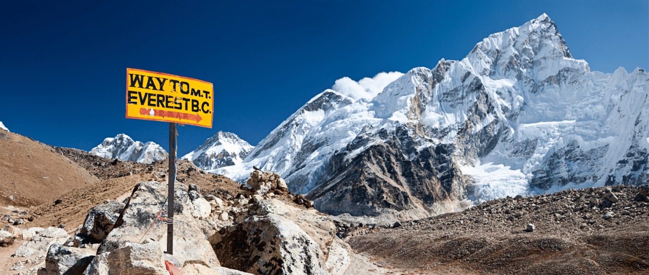
Reaching Everest Base Camp is an achievement in itself. Standing at the foot of the world’s highest mountain, at 5,364 meters, Everest Base Camp surrounds trekkers with the raw energy of the Kumbhu icefall. Here, you can do nothing but praise the serenity of nature.

After spending a few moments here, soaking in, reflecting on yourself and witnessing majestic peaks, photographing and video graphing, we return to Gorakshep.

If weather, time, and health allow, an optional hike to Kala Patthar for sunset views is an excellent choice. Sunset from Kala Patthar often offers clearer and more dramatic views of Everest than sunrise.

Gorakshep is extremely cold, and facilities are very basic. There are only about 5 teahouses that provide private rooms (requires advance booking), Wi-Fi, electricity, etc. There is no attached bathroom and hot shower facility available. We also do not recommend taking a bath, as there is a high chance of catching a cold and a risk of altitude sickness.

Max Elevation: 5364 meters (17,598 ft) at EBC
Duration: 8 to 9 Hours
Distance: 12 km (7.5 miles)
Accommodation: Teahouse
Meals: Breakfast, Lunch, and Dinner Included
Day 10:
Hike from Ghorakshep to Kala Patthar & trek to Dzongla Trek Route: Gorakshep → Kala Patthar → Gorakshep → Lobuche → Dzongla
  • Beginning Point: Gorakshep (5140 m/16,863.5 ft)
  • Ending/Overnight: Dzongla (4835 m/15,863 ft)
  • Gorakshep to Dzongla Distance: About 10 km (6.2 miles)
  • Maximum Elevation: 5550 meters (18,209 ft) at Kala Patthar
  • Total Ascent: 410 meters (1345 ft) from Gorakshep to Kala Patthar
  • Descent: 715 meters (2346 ft) from Kala Patthar to Dzongla
  • Lunch: Lobuche

For those who did not climb Kala Patthar the previous evening, they hike to Kala Patthar this morning. We need to start the hike early, around 4 am, to catch the sunrise view. So, packing headlamps is suggested.

Hike to Kala Patthar from Gorakshep takes about 2 hours. It’s a short but demanding walk due to altitude and loose terrain. However, the sunrise view over Mount Everest is worth every difficulty. It is the closest and clearest view of Everest that you can see, along with Nuptse, Lhotse, and the Khumbu Glacier.

After spending some time at the summit of Kala Patthar, we’ll descend back to Gorakshep, have our breakfast, and continue the trek towards Dzongla.

The trail from Gorakshep to Dzongla is relatively gentle and manageable. The path first leads back towards Lobuche, with mostly flat terrain and minor ups and downs. Compared to the previous days, this feels like a recovery walk.

From Lobuche, the trail diverges towards Dzongla and becomes noticeably quieter. Here onwards, the route gently traverses the hillside, passing along a beautiful alpine lake. Allow your body to rest and acclimate, and walk with a steady pace.

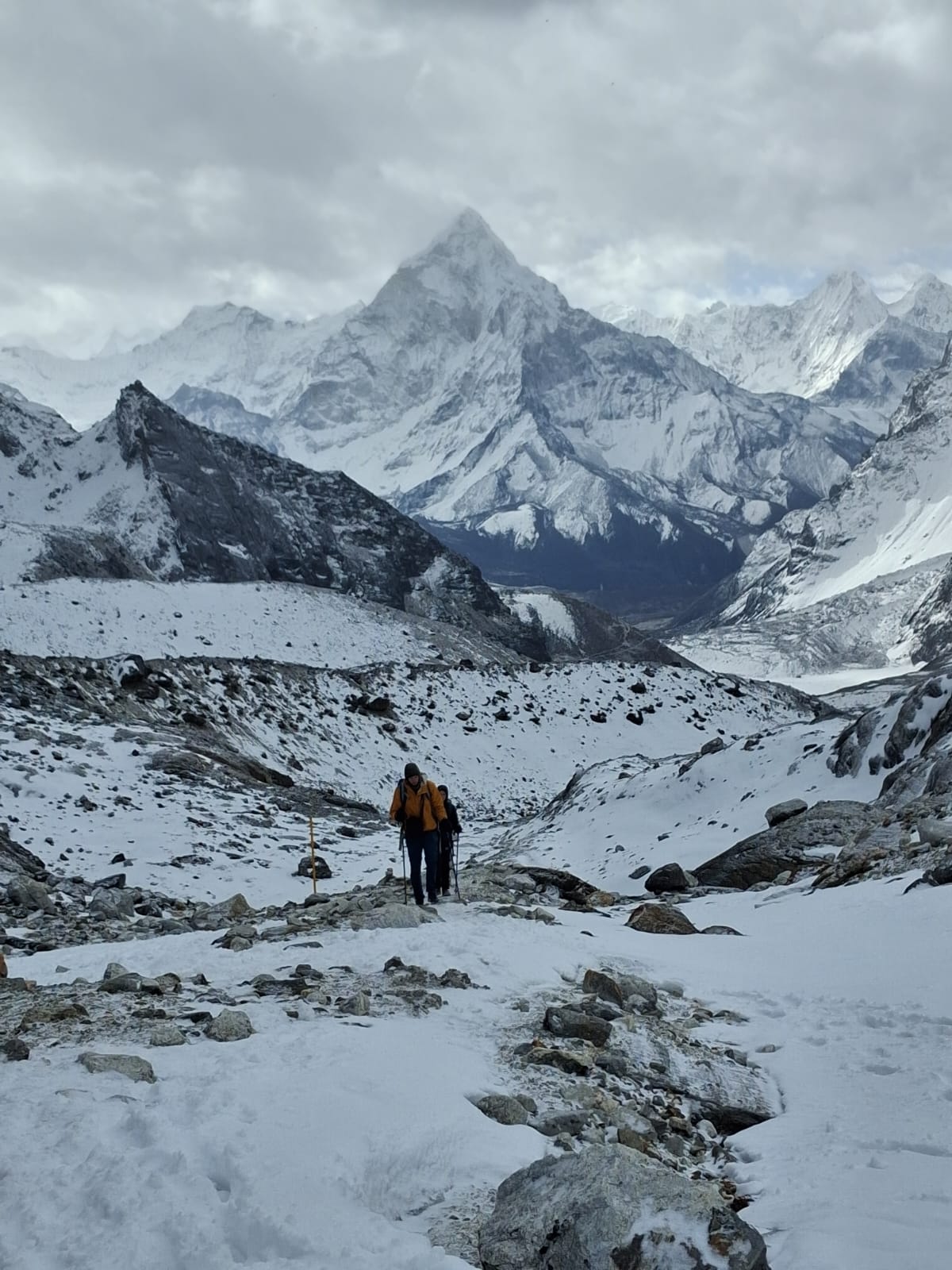
Throughout the trek, Ama Dablam becomes your companion, offering some of the best mountain views.

You may stop for lunch in Lobuche if needed, otherwise continue directly to Dzongla and have lunch upon arrival.

As you approach Dzongla, the region transforms into more remote and peaceful, making it a perfect place to rest and prepare for the upcoming Cho La Pass. A frozen lake lies nearby, and the views of Ama Dablam from Dzongla are particularly striking.

Dzongla is a small, quiet settlement with around 6-7 teahouses. They are basic yet good enough, providing a cozy bed to sleep in and a healthy meal to eat. Services like Wi-Fi, charging, hot showers, etc., might be limited and cost extra. However, you can charge your device in the dining hall, while enjoying the warmth of centrally heating stove.

Max Elevation: 5550 meters (18,209 ft) at Kala Patthar
Duration: 7 to 8 Hours
Distance: 10 km (6.2 miles)
Accommodation: Teahouse
Meals: Breakfast, Lunch, and Dinner Included
Day 11:
Trek to Thangnak from Dzongla Via Cho La Pass Trek Route: Dzongla → Cho La Pass → Thangnak
  • Beginning Point: Dzongla (4835 m/15,863 ft)
  • Ending/Overnight: Thangnak (4700 m/15,420 ft)
  • Dzongla to Thangnak Distance: 15-18 km (9-11 miles)
  • Maximum Elevation: 5420 meters (17,782 ft) at Cho La Pass
  • Total Ascent: 585 meters (1919 ft) from Dzongla to Cho La
  • Descent: 720 meters (2362 ft) from Cho La Pass to Thangnak
  • Lunch: Thangnak

Day 11 of the Everest Three Passes Trek is another challenging and rewarding day as you’ll cross Cho La Pass (5,420 m/17,782 ft). Cho La Pass is the second of the three high passes on the Everest Three Passes Trek.

Today, you’ll wake early, around 5:00 am, have some breakfast, and start the trek. The weather is stable, not windy, and firmer snow conditions during this time.

Carry a packed lunch if preferred; it should be ordered the previous night, though meals are available upon reaching Thangnak/Dragnak.

Leaving Dzongla, the trail climbs steadily over rocky and uneven terrain, gradually gaining elevation. As you approach the pass summit, the route becomes steeper and more rugged, with sections covered in snow or ice, depending on the season. So, we suggest packing crampons and careful footing for such conditions. It takes about 2.5 to 3 hours to reach the Cho La Pass summit.

From the top of Cho La Pass, trekkers can see dramatic views of glacier systems, surrounding peaks, and Prayer flags marking the crossing point.

After a short break, the descent begins. The route after the pass follows a gentler downhill trail leading into the Gokyo Valley, leaving the Khumbu Valley behind.

Now, the trail eases as you enter the Gokyo Valley. A final walk across the glacial moraine brings you to Thangnak. It’s an easy 2-3 hours walk.

Dragnak/Thangnak is a small settlement with 5-6 basic teahouses, surrounded by glacial landscapes and massive rock walls.

After you reach Thangnak, at around 11 to 11:30 am, you can order your lunch, rest, and freshen up.

After lunch, you can spend the rest of the day resting and hydrating. A short, gentle walk around the village or along the nearby Ngozumpa Glacier is possible if you feel comfortable. Most trekkers use the rest of the day to dry gear, reorganize backpacks, enjoy warm drinks, and share trekking experience with fellow trekkers.

After a challenging pass crossing, you are most likely tired, so we suggest you have an early dinner and go to bed early.

Max Elevation: 5420 meters (17,782 ft) at Cho La Pass
Duration: 8 to 9 Hours
Distance: 15-18 km (9-11 miles)
Accommodation: Teahouse
Meals: Breakfast, Lunch, and Dinner Included
Day 12:
Trek to Gokyo Lake from Thangnak Trek Route: Thangnak → Gokyo Lake
  • Beginning Point: Thangnak (4700 m/15,420 ft)
  • Ending/Overnight: Gokyo Lake (4790 m/15,715 ft)
  • Thangnak to Gokyo Lake Distance: 5 km (3 miles)
  • Total Descent: 90 meters (295 ft) from Thangnak
  • Lunch: Gokyo Lake

Today is a short and easy trekking day, allowing your body to recover after crossing Cho La. It’s obvious we’re tired from the previous day’s walk, and today it’s going to be a short 2-3 hours walk, so we can start the trek a little late.

After breakfast in Thangnak, we can begin our trek around 8 am. The trail follows the edge of the Ngozumpa Glacier, Nepal’s longest glacier.

Before gradually ascending toward Gokyo, you’ll need to cross rocky moraine and glacier debris.

As you approach Gokyo, the scenery opens up to turquoise Glacial lakesand wide alpine valleys. The route across the glacier might change depending on ice movement and conditions, but your guide will always choose the safest path.

Along with these turquoise lakes, you will reach Gokyo Village in no time.

Gokyo Village is often considered one of the most beautiful high-altitude villages in the Himalayas. The village is situated just beside the stunning Gokyo Lakes, reflecting the surrounding peaks on calm days. The atmosphere here is peaceful, with fewer trekkers compared to the Everest Base Camp route.

Once we arrive at the village, we’ll check into one of the best accommodations available and order our lunch.

After lunch, you have the rest of the day to rest, explore the village and lakeshore, and acclimatize, while soaking in views of Cho Oyu, Cholatse, and surrounding peaks.

If you feel like it, you can perform some yoga asanas and meditate by the shore of Gokyo Lake. A gentle walk around the lakes, exploring first, second, and third Gokyo Lakes, is also a good idea.

Use this time to hydrate well, organize gear, and mentally prepare for the next day’s hike to Gokyo Lake or the last pass crossing, Renjo La Pass, the day after.

An early dinner and good sleep are recommended, especially if you plan an early start the following morning.

Accommodation: Teahouse
Meals: Breakfast, Lunch, and Dinner Included
Day 13:
Acclimatization day at Gokyo Lake - Hike to Gokyo Ri or Fifth Lake Hike Route: Gokyo Lake → Gokyo Ri → Gokyo Lake
  • Gokyo to Gokyo Ri Distance: About 4 km (2.5 miles)
  • Elevation: 5360 meters at Gokyo Ri
  • Total Ascent: 570 meters (1870 ft) from Gokyo
  • Lunch: Gokyo/Packed lunch
  • Overnight: Gokyo Lake

Today is a crucial acclimatization and exploration day in the breathtaking Gokyo Valley. For a day hike, you have two options: “Hike to Gokyo Ri” or “Hike to the Fifth Lake”. These hikes are designed to hike higher and sleep lower, allowing your body to adapt safely while enjoying some of the best views in the Everest region.

Hike to Gokyo Ri (5,357 m/17,575 ft)

It is a steep but rewarding hike, taking 3-4 hours round-trip. You can either start early, reach the summit for sunrise, return for breakfast, or have breakfast first and hike afterward, returning for lunch.

From the top of Gokyo Ri, trekkers can enjoy an incredible panorama of four 8,000ers, including Everest, Lhotse, Makalu, and Cho Oyu, along with the Ngozumpa Glacier and turquoise Gokyo Lakes below.

Many trekkers choose to hike up before breakfast for a sunrise view.

Hike to Fifth Lake

It’s a little longer but gentler hike leading trekkers into remote Fifth Gokyo Lake. The hiking trail leads through glacial terrain and alpine ridges, providing a quieter experience with stunning views of Cho Oyu and surrounding glaciers.

After completing your hike, you have the rest of the day to yourself. You can have your lunch and spend the rest of the day resting and enjoying the pristine lakeside view from your teahouse.

Most trekkers choose to prepare for the final, 3rd-highest mountain pass on the Everest Base Camp and Three Passes Trek Itinerary: Renjo La Pass.

Max Elevation: 5360 meters at Gokyo Ri
Duration: Around 5 Hours
Distance: 4 km (2.5 miles)
Accommodation: Teahouse
Meals: Breakfast, Lunch, and Dinner Included
Day 14:
Trek to Lungden/Lumde From Gokyo Lake via Renjo La Pass Trek Route: Gokyo Lake → Renjo La Pass → Lungden
  • Beginning Point: Gokyo Lake (4790 m/15,715 ft)
  • Ending /Overnight: Lungden (4368 m/14,331 ft)
  • Gokyo Lake to Lungden Distance: About 8 km (5 miles)
  • Maximum Elevation: 5360 meters (17,782 ft) at Renjo La Pass
  • Total Ascent: 570 meters (1870 ft) from Gokyo Lake to Renjo La Pass
  • Descent: 992 meters (3255 ft) from Renjo La Pass to Lungden
  • Lunch: Lungden

Day 14 of the Three Passes Trek is the final and most scenic day. Today we will cross Renjo La Pass (5,360 m/17,782 ft).

For the most stable morning weather and clear mountain views, we start trekking early.

The day begins early, with breakfast around 5-5:30 am, followed by a gradual start on the trail by 6-6:30 am.

Leaving Gokyo, the trail climbs gradually at first and becomes steeper as you approach Bhanjyang/pass top. The ascent to Renjo La is generally more straightforward than the other two passes, though the final sections involve rocky, steep terrain. You might want to keep an eye on your footings.

It’s about a 2.5 to 3 hours’ ascent.

From the summit of Renjo La, you are rewarded with a spectacular 360° panorama, including Mount Everest, Lhotse, Makalu, Cho Oyu, the shimmering Gokyo Lakes, and wide-open views of both Gokyo Valley and Thame Valley.

This viewpoint is often considered the most beautiful of all three passes, making the entire trek worthwhile.

After spending some time at the pass, the trail descends steeply into the Thame Valley. The descent is less technical. However, for many trekkers, Decending is tougher. So, carefulness around these loose terrains is necessary.

The trail feels much quieter due to fewer trekkers, while there is a growing sense of returning to civilization after days spent in remote, high-altitude terrain, blending relief with a quiet sense of accomplishment.

A final walk brings to Lungden/Lumde, a small and quiet settlement with around 4-5 teahouses.

The teahouses here are basic but welcoming, offering warm meals, simple rooms, and a peaceful atmosphere. Lungden village itself is situated in a remote corner of the Thame Valley, surrounded by barren hills and high ridges.

Life here feels slow and traditional, giving trekkers a rare glimpse into authentic Sherpa mountain living, far from the limelight of the classic everest base camp trek route

Max Elevation: 5360 meters (17,782 ft) at Renjo La Pass
Duration: 7 to 8 hour
Distance: 8 km (5 miles)
Accommodation: Teahouse
Meals: Breakfast, Lunch, and Dinner Included
Day 15:
Trek to Namche Bazaar from Lungden/ Lumde Route: Lungden → Marulung → Thame → Namche Bazaar
  • Beginning Point: Lungden (4368 m/14,331 ft)
  • Ending/Overnight: Namche Bazaar (3440 m/11,286 ft)
  • Lungden to Namche Bazaar Distance: 13 km (8 miles)
  • Total Descent: 928 meters (3045 ft) from Lungden
  • Lunch: Thame

Today is another long but easy walk day, with mostly downhill trail.

After breakfast in Lungden, the trail gradually takes a quiet, scenic route to Namche Bazaar through Thame Valley. From Lungden, it takes about 2.5 hours to reach Thame, one of the oldest and most important Sherpa villages in the Khumbu region.

Thame is known for producing manyelite sherpa mountaineers and is home to the ancient Thame Monastery. A visit to Thame Monastery adds a meaningful cultural highlight to the trek.

Most likely, we’ll have lunch in Thame, or if you aren’t hungry, we can trek a little further to Thamo. Despite the damage from the 2025 flood, about 5-6 teahouses are up and running, with a strong community presence.

From Thame, the trail continues for another 2.5 hours towards Namche Bazaar, following the river valley. The route is mostly gradual with gentle ups and downs. This allows trekkers to walk comfortably.

As you approach Namche, the environment becomes livelier, busier, and better facilities. Reaching Namche Bazaar feels like re-entering civilization and a sense of achievement after days in remote and high-altitude valleys in the Solukhumbu region.

Here, you can take hot-warm showers, visit nearby internet cafes, a bakery, buy souviers, and stroll around Namche village Or, you can just relax and celebrate the journey so far.

An early dinner and good rest are recommended, as the following day involves the long descent toward Lukla


Max Elevation: Namche Bazaar (3440 m/11,286 ft)
Duration: 5 to 6 Hours
Distance: 13 km (8 miles)
Accommodation: Teahouse
Meals: Breakfast, Lunch, and Dinner Included
Day 16:
Trek From Namche Bazaar to Lukla Route: Namche Bazaar → Monjo → Phakding → Ghat → Lukla
  • Beginning Point: Namche Bazaar (3440 m/11,286 ft)
  • Ending/Overnight: Lukla (2840 m/9318 ft)
  • Namche Bazaar to Lukla Distance: 18.2 km (11.3 miles)
  • Total Descent: 600 meters (1968.5 ft) from Namche Bazaar
  • Lunch: Phakding

It’s the final trekking day of the Everest Three Passes Trek. The trail follows the familiar track back toward Lukla.

It’s a long walking day, nearly 7-8 hours, but mostly downhill. After breakfast, around 7-8 am, we’ll start descending steeply through pine and rhododendron forests towards Larja Dobhan, with Larja suspension bridges along the way.

After Larja Dobhan, the route is a mix of ups and downs, crossing several suspension bridges over the Dudh Koshi River. As you pass through villages like Monjo and Phakding, the air feels warmer, and the landscapes become greener; a different kind of energy fills the region.

The final section before Lukla involves a short uphill climb. Arriving in Lukla marks the official end of the trek and offers a feeling of both satisfaction and emotion.

This evening is often celebratory, with stories shared among guides and porters, and the last night in the mountains is enjoyed.

Max Elevation: Lukla (2840 m/9318 ft)
Duration: 7 to 8 Hours
Distance: 24 km
Accommodation: Teahouse
Meals: Breakfast, Lunch, and Dinner Included
Day 17:
Flight Back to Kathmandu from Lukla Flight Route: Lukla → Kathmandu
  • Beginning Point: Lukla (2840 m/9318 ft)
  • Ending Point: Kathmandu (1400 m/4593 ft)
  • Distance: 136 km (84.5 miles)
  • Total Descent: 1440 meters (4724 ft) from Lukla
  • Overnight: Kathmandu

After breakfast, you’ll head to Lukla Airport for the scenic mountain flight back to Kathmandu. This flight offers one last aerial view of the Khumbu region and Himalaya giants, a perfect end to the adventurous Everest Three Passes Trek.

Flight is usually operated in the early morning, directly to Kathmandu or via Ramechhap, depending on season and weather conditions. Weather delays are common in the Everest region. So, we suggest you keep a couple of buffer days before and after the trek.

If everything goes as planned, you’ll be back in Kathmandu quite early, and you’ll have the rest of the day to spend as you like. After a long and tiring trek, a relaxing spa or massage is a good idea. Strolling around Thamel is also a perfect idea.

Now that your trek is officially complete, you can share your experience with us, or we can meet for dinner.

Max Elevation: Kathmandu (1400 m/4593 ft)
Accommodation: Hotel
Meals: Breakfast Included
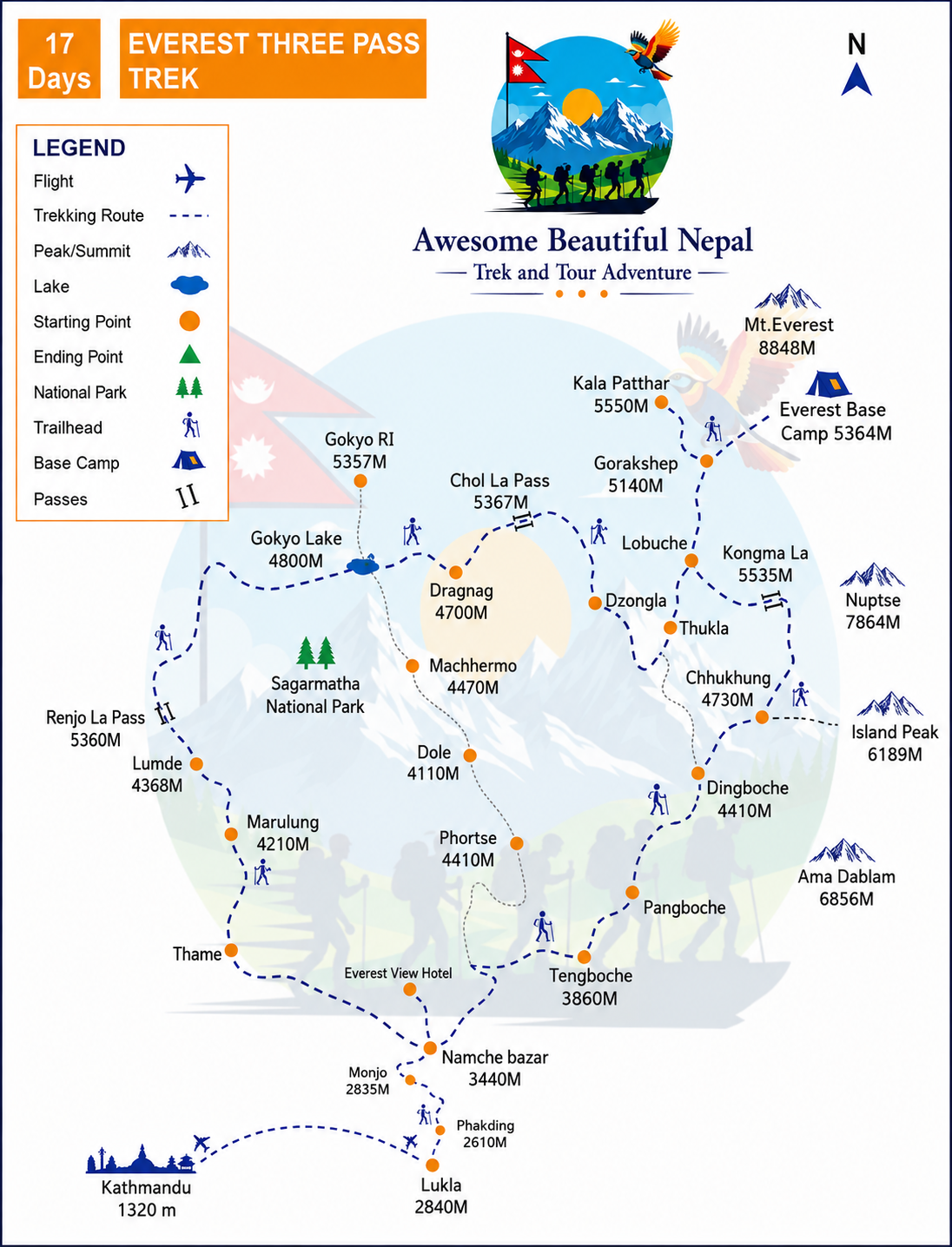
Map

Trip Inclusions

Transportation

  • Round-trip flight tickets for Kathmandu/Manthali and Lukla (Kathmandu–Manthali–Kathmandu travel via shared vehicle)
  • Private transportation to and from Kathmandu Airport and your hotel

Accommodations

  • Total 16 nights (Five nights at Lukla, Phakding and Namche(3N), rooms with a private attached bathroom, Eleven nights standard rooms at Thame, Lungden, Gokyo (2 N), Dzongla, Lobuche (2 N), Chhukung, Gorak Shep, Thangnak, Pheriche.

Food

  • Standard full-board meals (17 lunches, 16 dinners, and 17 breakfasts) with one main course per meal in trek regions
  • Water purification tablets for safe drinking water
  • Seasonal fresh fruits every day

Guide and Porter

  • Government licensed, English Speaking, experienced Discovery World Trekking trek leader (12 or above trekkers: 1 assistant guide)
  • Porters for trekkers luggage. One porter for two trekkers. 18kg maximum weight limit for a porter. One trekker luggage limit - 9kg.
  • Guides and porters coverage - meals, insurance, salary, lodging, transportation, flight, and necessary equipment

Trek Permits and Expenses

  • Sagarmatha National Park entry permit fee
  • Khumbu Pashang Lhamu Rural Municipality fees
  • All government, local taxes, and official Expenses

Medical Assistance

  • Rescue operation arrangement in case of complicated health conditions (funded by travel insurance)
  • Medical kits, including an oximeter to monitor blood oxygen saturation levels in high altitudes

Souvenir

  • Souvenirs

Farewell

  • Trekking certificate of appreciation after a successful trek
  • Farewell dinner at the end of the trek

Benefits

  • Sleeping bags and down jackets, duffle bag (one for every two trekkers) if you do not have your own
  • Free excess luggage storage at the AWESOME BEAUTIFUL NEPAL store for the duration of the trek

International Flight

  • International flight airfare

Accommodations

  • All accommodation in Kathmandu, before and after the journey
  • Extra night accommodation in Kathmandu due to early arrival or late departure, early return from the trek.

Food

  • All meals in Kathmandu, before and after the journey
  • Extra night meals in Kathmandu due to early arrival or late departure, early return from the trek.

Guide and Porter

  • Tips for guide and porters

Visa

  • Nepal Entry Visa Fees for multiple entries on arrival at Tribhuvan International Airport- (15 days - $25-30, 30 days- $40-50 and 90 days- $100-110)

Travel Insurance

  • Travel insurance that covers emergency high-altitude rescue and evacuation (compulsory)

Personal Expenses

  • Personal expense (shopping, snacks, boil bottle water, hot (tea, coffee) and cold drinks, hot shower, alcohol, Wi-Fi, telephone call, battery re-charge fee), extra porters, etc
  • Personal clothing and gear

Other Expenses

  • Excess baggage charges (Limit is 9kg per Person)
  • Additional costs due to delays caused by things beyond the company's control like landslides, weather conditions, itinerary modification due to safety concerns, illness, change of government policies, strikes, etc.
  • All the costs and expenses which are not listed in "What is included?"

Departure dates

Start Date
End Date
Price
Status
01 Oct, 2026
18 Oct, 2026
US$ 1650
Available
05 Oct, 2026
22 Oct, 2026
US$ 1650
Available
01 Nov, 2026
17 Nov, 2026
US$ 1650
Available
10 Nov, 2026
27 Nov, 2026
US$ 1600
Available
15 Nov, 2026
02 Nov, 2026
US$ 1600
Available

Departure dates

From 01 Oct, 2026
To 18 Oct, 2026
US$ 1650
From 05 Oct, 2026
To 22 Oct, 2026
US$ 1650
From 01 Nov, 2026
To 17 Nov, 2026
US$ 1650
From 10 Nov, 2026
To 27 Nov, 2026
US$ 1600
From 15 Nov, 2026
To 02 Nov, 2026
US$ 1600
Useful Informations

Everest Three High Passes Trek Package Information

Arrival, Welcome, and Trek Start

Upon arriving at Tribhuvan International Airport in Kathmandu, our representative will receive you with a pamphlet with your name. They will greet you with a Khada or marigold garland and take you to your hotel in a private vehicle.

The trek begins with a domestic flight to Lukla on your departure day. During peak trekking seasons (March, April, May, September, October, and November), flights to Lukla from Tribhuvan International Airport (TIA) may be redirected to Manthali Airport.

In such cases, on the trek departure day, our guide will pick you up from your hotel around 12:30 am for a five-hour drive to Manthali, followed by a 20-minute flight to Lukla.

In other months (December, January, February, June, July, and August), flights to Lukla typically operate directly from Kathmandu. On the trek departure day, we will take you to Kathmandu Airport early in the morning for a 40-minute flight to Lukla.

Accommodations

During the 17-day trek, you will stay at carefully selected lodges providing the best comfort in the Everest region.

You will stay in rooms with attached bathrooms for 5 nights at Lukla, Phakding, and Namche (3 nights) and twin-sharing standard rooms for 11 nights in Thame, Lungden, Gokyo (2 nights), Dzongla, Lobuche (2 nights), Chhukung, Gorak Shep, Thangnak, and Pheriche.

Most lodges offer hot showers, electricity for charging, and Wi-Fi for net access for a small fee.

Accommodations and meals in Kathmandu are not included, but the city offers a variety of options for all budgets.

Meals

We provide full-board (main course meals): 17 breakfasts, 17 lunches, and 16 dinners during the trek. Meals are prepared fresh, hygienic, and nutritious, with options including traditional Nepali, Asian, and Western dishes. Recommended local dishes include Dal Bhat (lentil soup and rice), Momos (dumplings), and Chowmein (noodles). We encourage trekkers to stay hydrated with beverages like green tea, ginger tea, and garlic soup.

We do not advise non-vegetarian food, dairy products, alcohol, and caffeinated drinks due to potential hygiene concerns and altitude effects. Personal bills for additional items like beverages (hot (tea/coffee)/ cold, and alcoholic drinks) and snacks are excluded.

Luggage

This package covers luggage up to 9 kg per trekker. One porter will carry the luggage of two trekkers, with a maximum load of 18 kg. Hence, we recommend you partner up with a fellow trekker and pack your things in a duffle bag of over sixty liters.

Facilities and Essentials

  • Water

We advise against drinking untreated water from rivers, taps, or wells in the trek region. You can buy bottled water, but for ecological reasons, we recommend you bring a water bottle and buy boiled/filtered water. Boiled/filtered water is available for a small fee at lodges and en-route shops. Further, we suggest you use water purification pills for extra safety. If you do not have water purification pills, we can provide them for you.

  • Communication

Awesome beautiful Nepal maintains daily contact with all trek teams through their leaders via mobile networks. Local SIMs are available in Kathmandu for personal use, but mobile signals may not be strong enough in high altitudes. Further, we are always on standby to handle emergencies.

Travel Essentials

  • Visa

Most nationalities require a visa to enter Nepal, obtainable upon arrival at Tribhuvan International Airport. The 30-day visa fee is USD 50. A valid passport with six months' validity and a passport-size photo are needed. SAARC and Chinese nationals may receive free visas, while some countries require pre-approval. You can visit the https://www.immigration.gov.np/en for detailed information.

  • Travel Insurance

Travel insurance covering medical coverage and emergency helicopter evacuation up to high-altitude trekking (up to 5,550 m) altitude is mandatory. Clients must provide policy details during booking. Do not just rely on the information insurers state on their website. Call them and specifically ask if the policy covers helicopter rescue.

  • Currency Exchange

Nepali Rupees (NPR) are used in the trekking regions (1 USD = ~151NPR). You can exchange major foreign currencies at banks or authorized money exchanges in Kathmandu. ATMs in Kathmandu allow withdrawals up to Rs. 35,000 per transaction for a fee. Please bring new, crisp, and clear notes as banks may not accept old or torn ones. Only INR (Indian Rupees) 100 note is legal in Nepal.

  • Extra Expenses

This package covers most expenses during the trek but not all of them. You will need money to cover other costs, such as meals and accommodations in Kathmandu, extra meal courses, snacks, beverages, tips, and souvenirs. We expect you will need around USD 15 per trek day.

Trek Season and Weather Conditions

The best trekking seasons are spring (March-May) and autumn (September-November) due to clear skies, pleasant temperatures, and stunning views. Each season temperature varies month by month. In spring, temperatures at high altitudes can rise to 20 °C during the day and drop to -5 °C at night. Similarly, in autumn, daytime temperatures can reach up to 25 °C, while nighttime temperatures may fall to -10 °C.

Treks are also conducted in summer (June-August) and winter (December-February). During summer, high-altitude temperatures can rise to 27 °C during the day and drop to 5 °C at night. In winter, daytime temperatures can reach 15 °C, while nighttime temperatures can plummet to -20 °C. However, summer's monsoon rains can make lower trails slippery and may cause flight delays. In winter, extreme cold and heavy snow at higher altitudes can make the trails challenging to navigate. 

  • Flight Delays

Flights to and from Lukla are occasionally delayed due to weather. We recommend allocating two buffer days to avoid conflicts with international flights. Helicopter transfers are available as a backup option at an additional cost of around USD 550, provided five persons share the cost.

Typical Day

Each day starts with an early breakfast before trekking begins between 7–8 AM. After 3–4 hours of trekking, you’ll stop for lunch, rest for an hour, and continue for 2–3 hours in the afternoon. After reaching the day’s destination, you are free to explore the new location on the Everest trail. We serve dinner at around 7 pm, followed by a briefing for the next day’s plan. Evenings are spent relaxing at lodges, playing games, socializing, etc.

Trip Conclusion

  • Farewell Dinner

After completing the trek,Awesome beautiful Nepal will host a farewell dinner during which you can provide us with your feedback. Later, we will present you with a trek achievement certificate.

  • Departure

On your departure date, we will provide a transfer from your hotel to Tribhuvan International Airport. We hope your trek with us is a cherished memory and look forward to seeing you again. However, you must provide us with your hotel name, room number, and departure date for this service.

Trek Bookings

  • Private Treks

We organize private treks only and do not add anyone to your group. Discounts are available for large groups. We can handle any group size and add an assistant guide for a group of 12 or more.

  • Safe Trek Bookings

Awesome beautiful Nepal is a Nepal-government-licensed and bonded trekking operator. Moreover, we are members of the Trekking Agency Association of Nepal (TAAN) and the Nepal Mountaineering Association (NMA). We require a 10% deposit to confirm bookings and the rest when you arrive in Kathmandu. You have several payment options - bank transfer, credit card, Western Union, or Wise. In Kathmandu, you can also pay in cash. We will email you the payment details.

  • Last-Minute Bookings

We prefer advance booking (at least one month in advance). However, we also have a provision for last-minute bookings. Last-minute bookings require full payment made 24 hours before departure. While we strive to conduct treks at all times, in case of last-minute bookings, delays due to factors beyond our control (such as flights and accommodations) may happen. Call Fero at 977-9861015344 or email info@AwesomebeautifulNepal.com after readying your important papers.

  • Flexible Schedule

We offer a fixed trek departure date. However, if your dates do not suit you, let us know your preferred dates, and we’ll adjust your trek accordingly.

  • Trip Extension

You can extend your stay in Nepal with optional activities such as jungle safaris, cultural tours in Kathmandu, or even another trek.

AWESOME BEAUTIFUL NEPAL FAMILY

Our guides and porters, born and raised in the high Himalayas, are well-trained, experienced, insured, and provided with proper gear, meals, and accommodations. A happy team ensures a memorable trekking experience for everyone. Our guides are government-licensed and trained in wilderness first-aid, and rock climbing.

Ecotourism Practices

Awesome beautiful Nepal is committed to eco-friendly travel. We collaborate with the Kathmandu Environmental Education Project (KEEP) to minimize our environmental impact while supporting local communities. Our goal is to leave only the footprints behind in the trek regions.

Tipping Culture

Tipping is a customary way to express gratitude for exceptional service. Though not mandatory, tips are encouraged at the trek’s conclusion and better provided as a group contribution. The tip amount needs to reflect the quality of service received, trek cost, and trek length.

Reviews

Leave a Review

Book Your Trip Now!

US $1700 x 1 guests: US $1700
Total US $1700
CUSTOMIZE

Similar Packages

image
Everest Region

Everest Base Camp Luxury Trek, 14 Days

0 reviews

$2500.00

14 Days Trip Details
image
Everest Region

Everest Chola Pass Trek

0 reviews

$1500.00

17 Days Trip Details
image
Everest Region

Everest Panorama EBC Trek

0 reviews

$1199.00

10 Days Trip Details